Urban Hotspots
The Urban Planning Tool Urban Hotspots identifies optimal locations within a city for a specific activity by evaluating proximity between urban facilities and inhabitants, at local/ neighborhood /city levels across the metro. It includes two search functionalities, the layer, and the filter, which correspond to indicators, planning standards, and national government’s norms essential for spatial planning (population, employment, density, land use, etc.). These functionalities grant flexibility to decision-makers, to explore multiple combinations of urban spatial planning parameters that capture and respond to the city’s needs and challenges.
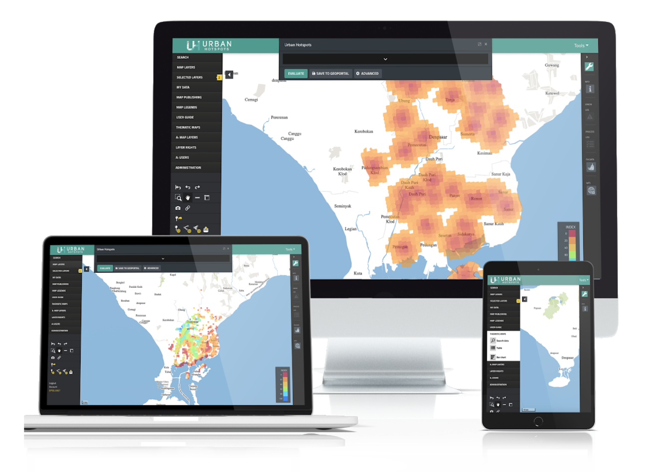
Urban Hotspots is a web application that uses multicriteria analysis techniques for agile spatial analysis. With Urban Hotspots, users can create heat maps of access to urban services within minutes or find optimal locations for a specific activity within a city.
Brochures
The brochure explains the main functionalities of the tool in a brief one-pager pamphlet.
Case studies
The case studies include a selection of applications that we have performed with the Urban Hotspots tool.
User Manual
The user manual explains all functionalities in Urban Hotspots.
Technical Report
The technical report includes a comprehensive theoretical base for the Urban Hotspots tool, as well as a detailed description of methods, data inputs, required formats, and outputs.
Acknowledgements
We acknowledge the invaluable support of the World Bank’s Trust Fund for Statistical Capacity Building (TFSCB) in making this project. This tool was conceptualized at City Planning Labs with the technical support from SITOWise. The tools were developed by CAPSUS and are maintained by UPTech and a community of developers.