About
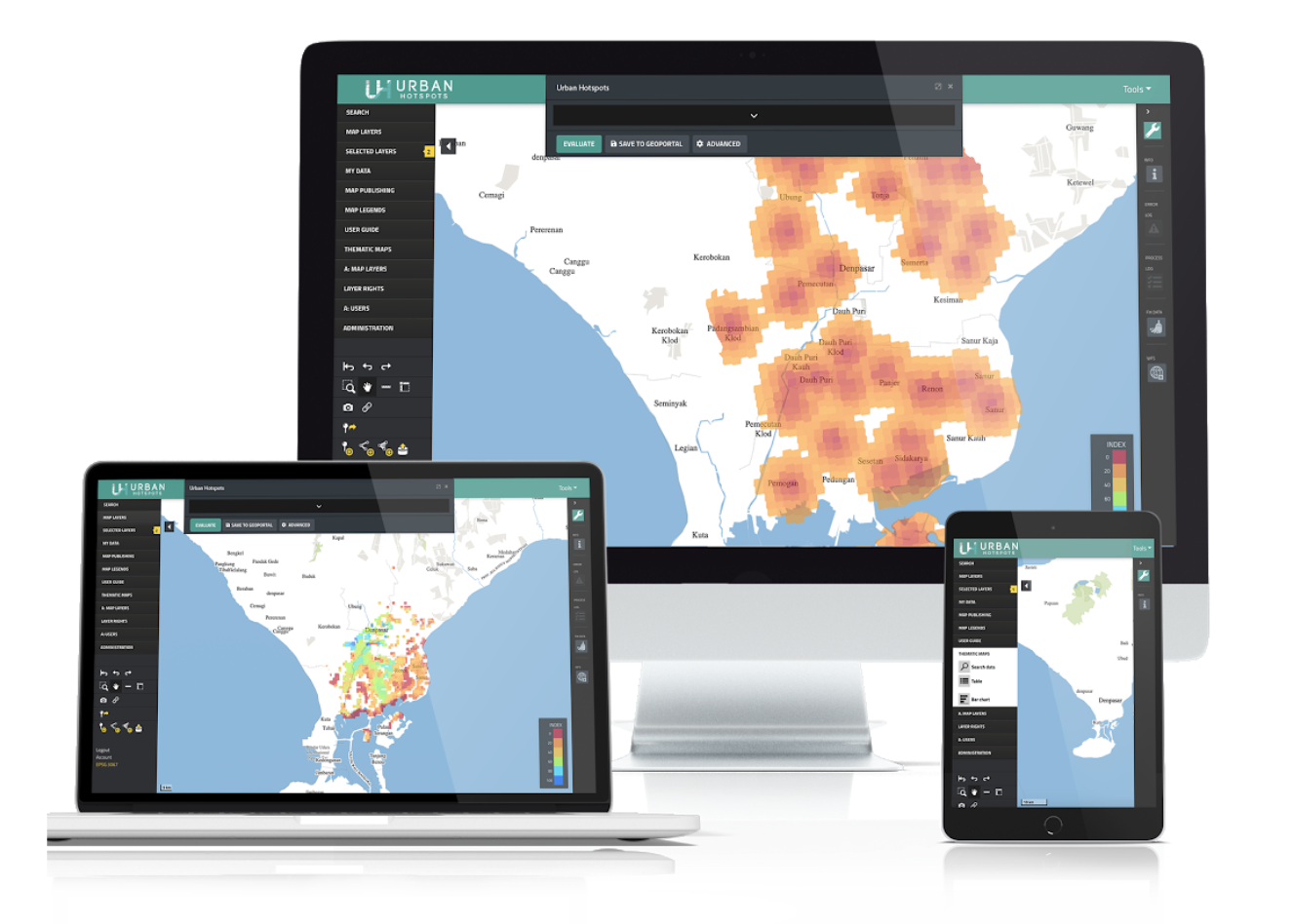
Our geoportal is a web application that can be used to store, share, find, and access geospatial data. The tool is based on Oskari and can be used to capture or upload spatial data. Both tools, Urban Hotspots and Urban Performance run inside the Geoportal as plug-ins. And can be used to perform analysis right in the Geoportal.
Urban Performance (UP)
To analyze possible future scenarios, we created Urban Performance. A tool that, through the analysis of geospatial data, forecasts the city’s future performance and helps us in choosing the best path forward.
Urban Hotspots (UH)
Urban Hotspots is a web application that uses multicriteria analysis techniques for agile spatial analysis. With SuitAbility, users can create heat maps of access to urban services within minutes or find optimal locations for a specific activity within a city.
Brochures
Brochures explain the main functionalities of each tool in a brief two-pager pamphlet.
Case studies
Case studies include a selection of applications that we have performed with the tools.
User Manuals
User manuals explain all functionalities in the UPT (Urban Performance and Urban Hotspots) in order to run evaluations.
Technical Reports
Technical reports include a comprehensive theoretical base for the tools, as well as a detailed description of methods, data inputs, required formats, and outputs.
Acknowledgements
We acknowledge the invaluable support of the World Bank’s Trust Fund for Statistical Capacity Building (TFSCB) in making this project. This tool was conceptualized at City Planning Labs with the technical support from SITOWise. The tools were developed by CAPSUS and are maintained by UPTech and a community of developers.